Archives Record
Images
Additional Images [49]
Metadata
Catalog Number |
2012.29.1 |
Object Name |
Map |
Title |
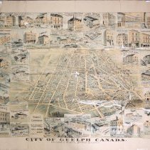
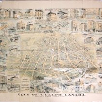
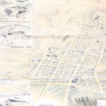
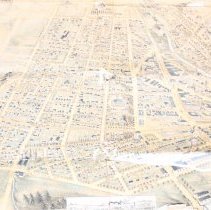
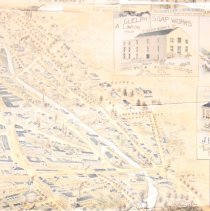
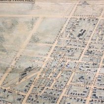
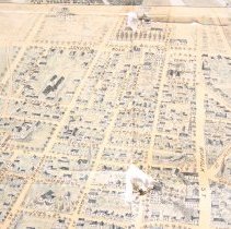
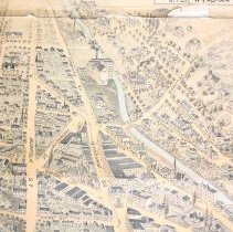
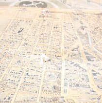
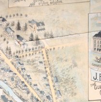
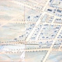
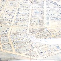
Illustrated Map, Guelph, circa 1900 |
Date |
circa 1900 |
Year Range from |
1895 |
Year Range to |
1905 |
Description |
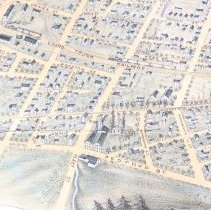
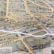
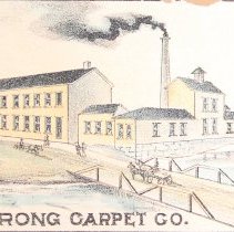
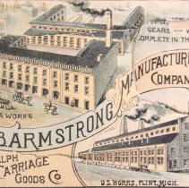
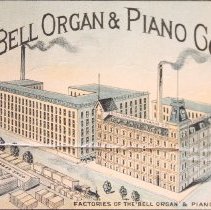
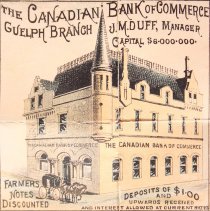
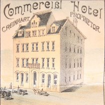
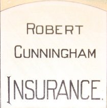
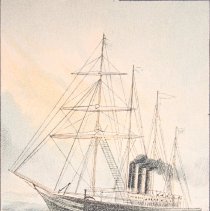
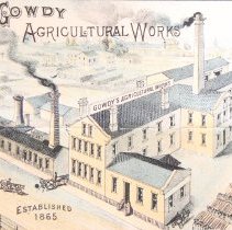
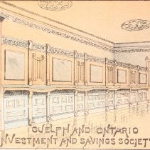
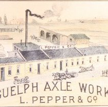
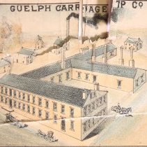
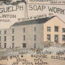
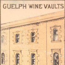
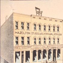
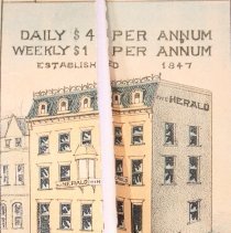
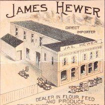
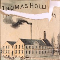
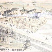
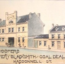
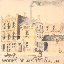
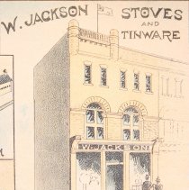
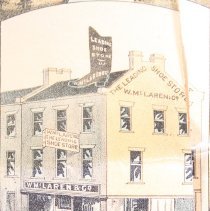
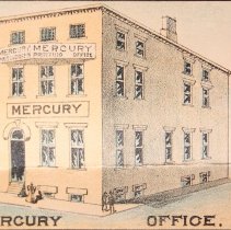
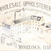
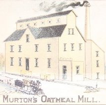
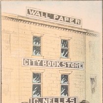
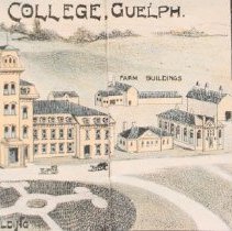
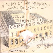
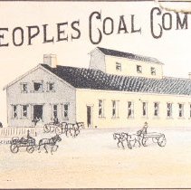
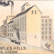
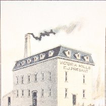
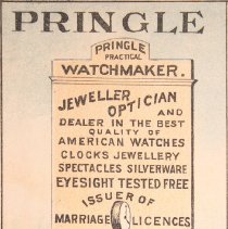
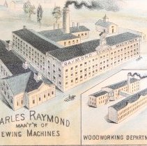
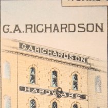
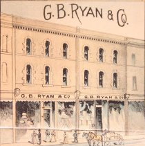
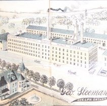
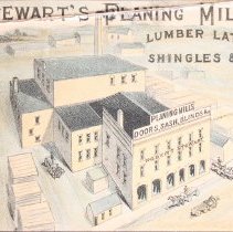
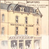
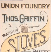
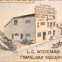
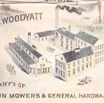
Map of Guelph with illustrations of businesses around the edge, circa 1900. The map depicts the layout of the city, with streets, railways, houses, churches, factories, businesses, and trains drawn on the map (depicts the building as though 3D). There are 41 illustrations of businesses around the outside of the map. The title of the map is along the bottom edge "City of Guelph Canada with Views of Principal Business Buildings." The businesses represented on the map are: Guelph Carriage Top Co. Commercial Hotel - C. Reinhart Proprietor Penfold's Carriage Works Murton's Oatmeal Mill Geo. J. Thorp Seedsman Canadian bank of Commerce James Hewer Flour Feed and Produce Mercury Guelph and Ontario Investment and savings Society James Hough Jr. Guelph Wine Vaults G.A. Richardson Hardware C. Nelles Bookseller The Herald - H. Gummer Proprietor W. Jackson Stoves and Tinware Ontario Agricultural College Presants Flour Mill Hazelton Block - King & Sullivan Furniture; Walker & Sons Wholesale Fruits; Hazelton, Stubbs & Walker John Davidson's Insurance Thomas griffin Stoves - Union Foundry Pringle Watch maker Stewart's Planing Mill Homewood A.R. Woodyatt Morlock Bros. Bell Organ and Piano Co. G.B. Ryan & Co. The People's coal Company Guelph Axle Works - L. Pepper & Co. Robert Cunningham Insurance Gowdy Agricultural Works Sleeman Brewery - George Sleeman Raymond Sewing Machine Company - Charles Raymond W. McLaren & Co. Shoe Store People's Mill - James Goldie Thomas Holliday - Guelph Brewery Armstrong Carpet Co. Hooper's Livery Blacksmith & Coal Dealer Guelph Carriage Goods Co. - J.B. Armstrong L.C. Wideman Carpenter and Builder Guelph Soap Works - A. Linton Proprietor |
Notes |
Mapmaking is an ancient, global, and subjective practice. Maps can help us to understand land relationships over time. It is important to understand why a specific map was made, whose interests it reflected, and how it was intended to be used. These understandings are shaped by knowledge of the land from diverse perspectives, past, present, and future. Historical Context: Early Indigenous navigational maps of the place we now call Canada were drawn on impermanent materials, accompanied by verbal descriptions and committed to memory. Landmarks were accentuated to aid travellers and scale was often measured by time (such as, a day's journey). In about 1502, European mapmakers depicted the east coast of Newfoundland as an island in the North Atlantic. World maps skewed the size and shape of continents and used colour to symbolize colonial powers. The first surveyors measured and marked plots of land - taken, traded, granted, or sold - often naming the landholders on the map. Today, the science and practice of mapmaking documents the topography of the landscape in fine detail, through aerial photography, sensors, satellites, and global positioning/information systems (GPS/GIS). |
People |
Armstrong, J.B. Cunningham, Robert Davidson, John Griffin, Thomas Gummer, Henry "Harry " Hewer, James Holliday, Thomas Hough Jr., James Jackson, W. Linton, A. Nelles, Charles L. Pepper, L. Raymond, Charles Reinhart, Christian Richardson, G.A. Sleeman, George Thorp, George J. Wideman, L.C. |
Search Terms |
Armstrong (J.B.) Manufacturing Company Armstrong's Carpet Factory Bell Piano and Organ Company Limited Blacksmith Fountain Canadian Imperial Bank of Commerce (CIBC) Commercial Hotel Cunningham (Robert) Insurance Davidson (John) Insurance Goldie's Mill Gowdy Agricultural Works Griffin (Thomas) Stoves Guelph and Ontario Investment and Savings Society Guelph Axle Works Guelph Brewery Guelph Carriage Goods Company Guelph Carriage Top Company Guelph Herald Guelph Hydro Guelph Mercury Guelph Soap Company Guelph Wine Vaults Hazelton Block Hazelton, Stubbs and Walker Hewer (J.) Produce Storage Holliday Brothers Brewery Homewood Health Centre Hooper (John) Blacksmith Hooper's Livery Hough Printer Jackson (W.) Stoves and Tinware King and Sullivan McLaren (W.) and Company Morlock Brothers Murton's (Harry) Mill Nelles (Charles L.) Stationer Ontario Agricultural College (OAC) Penfold's Carriage Works People's Coal Company Pepper Axle Works Presant's Mill Pringle (G.D.) Jewellery Store Raymond Sewing Machine Company Richardson (G.A.) Hardware Ryan (G.B.) and Company Department Store Sleeman Brewing and Malting Company Stewart Lumber Streetcar Thorp's Seed Store Union Foundry Walker (Hugh) and Son Wideman (L.C.) Carpenter and Builder Woodyatt (A.R.) Company |
Subjects |
ADVERTISEMENT COMMERCIAL MAPS TRANSPORTATION - CARRIAGES TRANSPORTATION - STREET RAILWAY |
Dimensions |
114 cm w x 81.5 cm l |
Collection |
Archives |