Archives Record
Images
Metadata
Catalogue Number |
1984.4.8 |
Object Name |
Map |
Title |
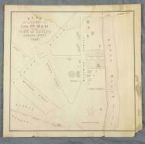
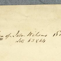
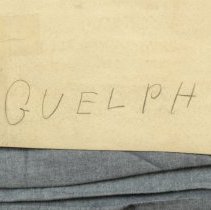
Map, Town of Guelph, John Wilson, 1856 |
Date |
1856 |
Year Range from |
1856 |
Year Range to |
1856 |
Description |
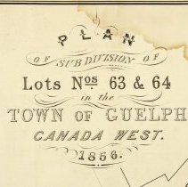
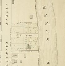
Map of the Town of Guelph, sureyed by John Wilson, drawn by Alex W. Simpson, dated to 1856. The map depicts 16 building lots between the north side of Woolwich Street and the south bank of Speed River. The map features a stable, and the "Court House" Inn (in quotes on map) both on Woolwich Street. It also includes Market Square, the Grand Trunk Railway, Quebec, Wooolwich, Wyndham, Cork, Macdonnell, River, Thorp and Eramosa Streets. Thorp Street connects to a bridge over Speed River, there is also a bridge at Eramosa Street. Map is printed in black ink on paper. |
Notes |
Mapmaking is an ancient, global, and subjective practice. Maps can help us to understand land relationships over time. It is important to understand why a specific map was made, whose interests it reflected, and how it was intended to be used. These understandings are shaped by knowledge of the land from diverse perspectives, past, present, and future. Historical Context: Early Indigenous navigational maps of the place we now call Canada were drawn on impermanent materials, accompanied by verbal descriptions and committed to memory. Landmarks were accentuated to aid travellers and scale was often measured by time (such as, a day's journey). In about 1502, European mapmakers depicted the east coast of Newfoundland as an island in the North Atlantic. World maps skewed the size and shape of continents and used colour to symbolize colonial powers. The first surveyors measured and marked plots of land - taken, traded, granted, or sold - often naming the landholders on the map. Today, the science and practice of mapmaking documents the topography of the landscape in fine detail, through aerial photography, sensors, satellites, and global positioning/information systems (GPS/GIS). |
People |
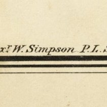
Simpson, Alex W. Wilson, John |
Search Terms |
Cork Street Court House Court House Hotel Eramosa Bridge Eramosa Road Grand Trunk Railway Grand Trunk Railway Station Guelph Jail Macdonell Street Market Square Quebec Street Registry Office River Street Speed River St. George's Church St. George's Square Thorp Street Woolwich Street Wyndham Street |
Subjects |
MAPS |
Collection |
Archives |