Archives Record
Images
Additional Images [5]
Metadata
Catalog Number |
1981X.229.1.4 |
Object Name |
Map |
Title |
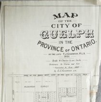
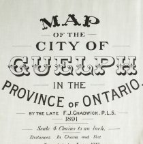
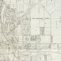
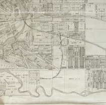
Map, Guelph, 1913 |
Date |
June 1913 |
Year Range from |
1913 |
Year Range to |
1913 |
Description |
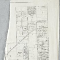
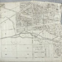
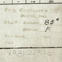
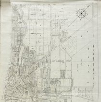
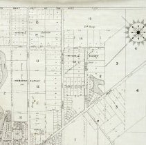
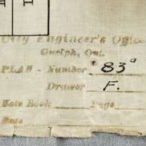
Map of Guelph consisting of four separate sections (.1-.4) that when pieced together create the full map. Originally surveyed by F.J. Chadwick in 1891, and corrected to June 1913 by E.E. Clawson. .1 - Has the original title of the map, and includes Willow Road, Edinburgh Road, Paisley Street and Hanlon Street. .2 - Includes the railway across the centre, and Speedvale, Woolwich, Oxford, and Edinburgh Road. .3 - Depicts the Speed River from left to right, and includes Paisley, Oxford, Norfolk, Gordon Street, Forest and Hanlon Streets. .4 - Is the largest map section, and depicts the land around the north-west portion of the Speed and Eramosa Rivers, including Speedvale Avenue, Dundas Road, Gordon Street, Norfolk, and Woolwich Streets. Each section also depicts lot numbers, lot divisions, street names, surveys, and owners of large portions of land. The map, its text and border, have been printed in black ink. |
Notes |
Mapmaking is an ancient, global, and subjective practice. Maps can help us to understand land relationships over time. It is important to understand why a specific map was made, whose interests it reflected, and how it was intended to be used. These understandings are shaped by knowledge of the land from diverse perspectives, past, present, and future. Historical Context: Early Indigenous navigational maps of the place we now call Canada were drawn on impermanent materials, accompanied by verbal descriptions and committed to memory. Landmarks were accentuated to aid travellers and scale was often measured by time (such as, a day's journey). In about 1502, European mapmakers depicted the east coast of Newfoundland as an island in the North Atlantic. World maps skewed the size and shape of continents and used colour to symbolize colonial powers. The first surveyors measured and marked plots of land - taken, traded, granted, or sold - often naming the landholders on the map. Today, the science and practice of mapmaking documents the topography of the landscape in fine detail, through aerial photography, sensors, satellites, and global positioning/information systems (GPS/GIS). Biographical Context - Frederick Jasper Chadwick Frederick Jasper Chadwick was the second son of John Craven Chadwick (Senior). He was born on 19 November 1838, and died on 20 June 1891. He was the Captain of the Wellingon Milita, a Provincial Land Surveyor, and the owner of the Guelph Herald newspaper for several years. He was a member of the County Council in the County of Wellington and served on the Town Council of Guelph (of which he was Mayor in 1877) multiple times. He married on 3 September 1861 to Elisabeth (died 3 August 1894), who was the daughter of Edward Michael Stewert (in Holy Orders of Guelph and afterwards of Clooney, County Derry, Ireland) and Jane Renwick Jeffery. Research Resources: Edward Marion Chadwick, The Chadwicks of Guelph and Toronto and Their Cousins, (1845), 59. https://www.forgottenbooks.com/en/download/TheChadwicksofGuelphandTorontoandTheirCousins_10652782.pdf |
People |
Chadwick, Frederick Jasper Clawson, Ernst |
Search Terms |
Albert Street Alma Street Argyle Street Barton Street Bedford Street Beechwood Avenue Bellevue Street Birmingham Street Bristol Street Cambridge Street Cedar Street Chadwick Avenue Chester Street Clinton Street Cork Street Crimea Street Division Street Dundas Road Edinburgh Road Edinburgh Road Essex Street Exhibition Street Fergus Street Fleet Street Forbes Avenue Forest Drive Forest Drive Galt Street Gladwin Street Glasgow Street Gordon Street Grand Trunk Railway Grand Trunk Railway Station Harrison Avenue Hearn Avenue Hospital Street Inkerman Street James Street Kathleen Street Kent Street Manchester Street Maple Street Mary Street McGee Street Meadowview Avenue Norfolk Street Northumberland Street Omar Street Oxford Street Paisley Road Preston Street Raglan Street Robinson Avenue Southhampton Street Speed River Speedvale Avenue St. Andrews Street St. Arnaud Street Stanley Street Stanley Street Sydenham Street Victoria Road Water Street Wellington Boulevard Willow Road Woolwich Street |
Subjects |
MAPS LAND RECORDS |
Dimensions |
.1 Willow Road, Edinburgh Road, Paisley, Hanlon 58.2cm x 45.2cm .2 Speedvale, Woolwich, Oxford, Edinburgh 62cm x 40.5cm .3 Paisley, Oxford, Norfolk, Gordon, Forest, Hanlon 71.5cm x 64cm .4 Speedvale, Victoria, Speed River, Dundas Road, Gordon St., Norfolk, Woolwich St. 120cm x 76.8cm |
Collection |
Archives |