Archives Record
Images
Additional Images [18]
Metadata
Catalog Number |
1978X.00.191 |
Object Name |
Map |
Title |
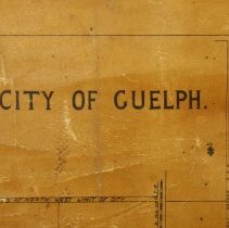
Map, Wellington County, 1880 |
Date |
1880 |
Year Range from |
1880 |
Year Range to |
1880 |
Description |
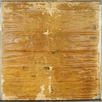
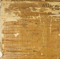
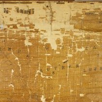
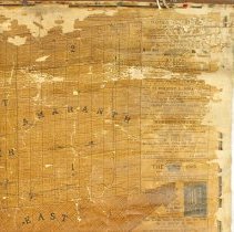
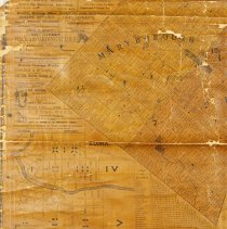
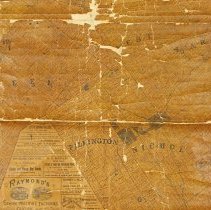
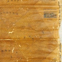
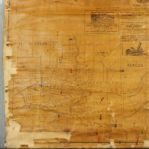
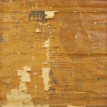
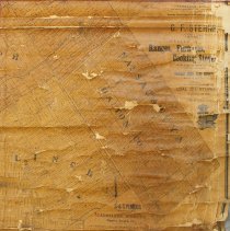
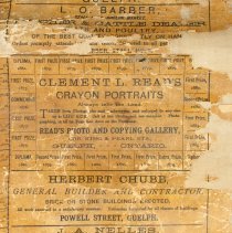
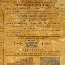
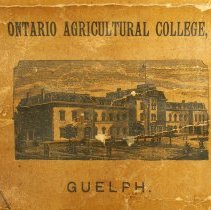
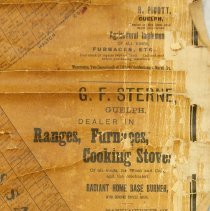
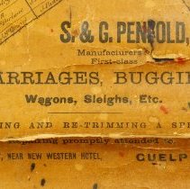
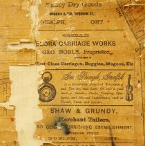
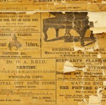
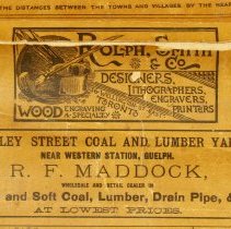
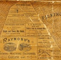
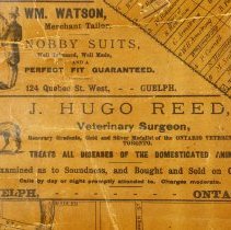
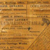
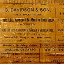
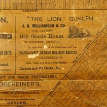
Map of Wellington County, dated to 1880. The map depicts Wellington County, land lots, and the names of landowners. There are advertisements around the edge from Guelph, Fergus and Elora businesses. The map is composed of paper with a fabric backing, and has been tacked to a wooden dowel across the top and bottom. There are two eye hooks and a string on the top for hanging. |
Notes |
Mapmaking is an ancient, global, and subjective practice. Maps can help us to understand land relationships over time. It is important to understand why a specific map was made, whose interests it reflected, and how it was intended to be used. These understandings are shaped by knowledge of the land from diverse perspectives, past, present, and future. Historical Context: Early Indigenous navigational maps of the place we now call Canada were drawn on impermanent materials, accompanied by verbal descriptions and committed to memory. Landmarks were accentuated to aid travellers and scale was often measured by time (such as, a day's journey). In about 1502, European mapmakers depicted the east coast of Newfoundland as an island in the North Atlantic. World maps skewed the size and shape of continents and used colour to symbolize colonial powers. The first surveyors measured and marked plots of land - taken, traded, granted, or sold - often naming the landholders on the map. Today, the science and practice of mapmaking documents the topography of the landscape in fine detail, through aerial photography, sensors, satellites, and global positioning/information systems (GPS/GIS). |
People |
Barber, L.O. Bollert, Ernest R. Chubb, Herbert Hetherington, C. Howitt, C.E. Maddock, R.F. Maitland, H.K. McBean, A. McCormick, M. Nelles, J.A. Petrie, Thomas S. Pigott, R. Pringle, George Read, Clement L. Reed, J. Hugo (Dr.) Smith, W.G. Sterne, George F. Stewart, Robert Thain, Charles Watson, William Williamson, J.D. |
Search Terms |
Barber's Butcher Shop Bollert (E.R.) and Company Campbell's Shoe House Cardigan Street Chubb (Herbert) Contractor City Livery Cormack and Keleher Davidson (C.) and Son Day's Block Dobereiner (Philip) Photography Douglas Street Guelph Business College Hetherington (Charles) Photography Howitt's Banking Office Jones Dry Goods Company King Street Lion Dry Goods Maitland (H.K.) Vocal and Instrumental Music Teacher Masonic Block McBean and Company Hardware Mitchell and Company Funeral Services Nelles (J.A.) Bookseller and Stationer Ontario Agricultural College (OAC) Paisley Street Coal and Lumber Yard Pearl Street Penfold's Carriage Works Picture Gallery Powell Street Pringle (G.D.) Jewellery Store Quebec Street Raymond Sewing Machine Company Read (Clement L.) Artist Reed (J. Hugo) Veterinarian Royal City Drug Store Royal Hotel Shaw and Grundy Smith (W.G.) and Company Stewart Lumber Thain (Charles) Wagons Waters Brothers Picture Gallery Watson (W.) Merchant Tailor Wellington County Western Hotel Western Station Williamson (J.D.) and Company Wyndham Street |
Subjects |
MAPS ADVERTISEMENT |
Collection |
Archives |